Wednesday, August 10, 2011

Two Days, Two Peaks


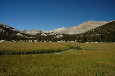
So, my mission to climb some mountains, and the decision to find inspiration by starting with California's 14ers, led me to target Mount Tyndall (14,018') and Mount Williamson (14,375). These two peaks lie within spitting distance of each other on the Sierra crest just west of Independence, CA and a few miles north of Mount Whitney. Neither of them are very technical, with the most difficult sections being very short and rated Class 3 at most. In fact, many reports list the hike in to the base of the mountains as the crux of the climb. The approach takes the Shepherd Pass trail for 10+ miles and reaches the Sierra Crest at Shepherd Pass (duh) which is just north of Williamson and Tyndall. The trailhead is at about 6200', so with a few ups and down on the trail and two 14ers to climb there is a lot of elevation gain involved in climbing these peaks.


My attempt on the mountains began in my bed in Sherman Oaks at 4:45am on a Monday. I had packed my backpack the night before and was ready to hit the road quickly. I tore my head off the pillow and dragged myself to the bathroom to get ready. Eventually, I was on the road making good time to Lone Pine to get wilderness permit at the ranger station. The ranger station opens at 8am and it takes about 3 hours for me to get there from my apartment. I got my permit quickly, right after 8 and hopped back int he car to see how close I could get to the trailhead. The road to the trailhead has about a two mile section that is listed as high clearance/ 4wheel drive and my honda civic is neither of those. I was expecting to have to park over a mile away and take the stock trail from an even lower elevation. However, I missed the parking for the stock trail and after about 5 mintues of driving along a relatively rough road (which was my no mean the worst I had been on in my car) I realized with some excitement that I was almost at the higher trailhead.


I started hiking right around 9:15am. The Shepherd Pass trail actually starts out heading up along Symmes Creek to avoid some big cliffs at the bottom of Shepherd Creek Canyon. After about a mile you switchback for a long time up and over a ridge that separates Shepherd Creek and Symmes Creek. Once you leave Symmes creek the terrain gets pretty dry and stays that way for a long time. A long stretch of sandy trail leads up above Shepherd Creek to Anvil Camp (10k ft), which is basically just a nice place to camp under some trees along the creek. It was at Anvil Camp that I managed to get myself off trail. For some reason, I was sure the trail stayed on the north side of the creek and as such I wandered off to the north looking for a trail that (in my head) continued from a turn off that I missed.


So I wandered off trail through some talus and meadows until I rejoined the trail at the Pothole (10,800'), another small camping area. Fortunately this wandering led me to some of the best wildflowers that I saw on the hike. Lots of my favorite, columbine, growing in the talus.


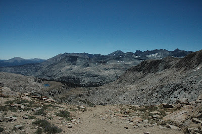
Once I rejoined the trail, I made good progress up to the pass, although I did encounter patches of snow with more frequency. Just below the pass the trail was partially covered with snow and I happened to lose the trail again. I did not see that the trail switched backed up to the pass off to the right of the snow chute. Only the left most corners of the trail were covered with snow. Not seeing this detail, I decided to follow what appeared to tracks that went straight up the snow chute. I was prepared for snow travel so this was not even an issue, it was hard steep going but I didn't even need to put on my crampons for secure footing. A few minutes later I arrived at the top of Shepherd Pass and began heading cross country towards the base of Tyndall.


My original plan was to hike in on the first day and camp near the base of Tyndall, get up early the second day, climb both Tyndall and Williamson and then pack up and head back down to the car. However, I arrived at a suitable campsite around 4:30pm after about 7:15 on the trail. I decided that this would leave me plenty of time to summit Tyndall on the evening of the first day and leave only Williamson for day two. The weather looked perfect, so after a brief break I took off for the North Rib route with a wonderfully light pack.


The North Rib route is not too steep and doesn't involve a lot of difficult climbing, mostly what people describe as scrambling. However, "not too steep" is a relative term in the mountains, and in this case it means that I generally felt comfortable standing at just about any point on the climb, but I gained elevation quickly and had to take a number of breaks to catch my breath. As often happens in the mountains, I felt as if I was getting my butt kicked by the climb, but I reached the ridge at the top of the Rib and very soon after the summit. I checked the clock and discovered that it had only taken about 70 minutes from my camp to the top.


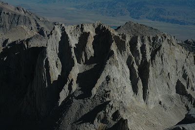
And holy crap, what a day on the summit! It was absolutely gorgeous, warm air with no wind, clear skies and the sun drooping towards the horizon lending wonderful color and shadows to the landscape. I spent nearly an hour on the summit, taking pictures, making phone calls, shooting videos and just hanging out enjoying everything about being on the summit.


The trip back to camp was even faster, and I went to bed excited to climb Williamson the next morning.


I had made the decision to carry my heavy/warm sleeping bag along on this trip and I slept quite comfortably. Somehow, I managed to wake up quite early anyway and after a few attempts to go back to sleep I decided to just get going towards Williamson. I started walking around 5am and I had my head lamp turned off almost immediately. the approach to the base of my route up Williamson's west face crossed most of the Williamson Bowl. Crossing the Bowl involves quite a few up and downs which I had expected and they were no big deal. For the trip across the Bowl I left my ice axe and crampons at camp on the advice of some folks I had met on the trail the previous day. This was almost great advice, I had no need for my snow equipment for 99.99% of the route. Unfortunately, that .01% was a 30' section of steep snow that appeared to be unavoidable. And at 5:30am the snow was frozen solid and for the life of me I could not kick steps in the snow with my boots. I spent about 15 minutes trying to descend that 30' snow slope, standing on tiny divots in the snow, trying to dig my fingers into the ice and generally crapping my pants. In the end I slid the last 10 feet to a bar of rock and sand, landed safely and breathed a big sigh of relief.


After that, I crossed the rest of the Bowl in the predawn light without incident and started up the West Face route. To be honest, the west face route is not too interesting, there is some loose stuff in it, but it is possible to avoid most of it. It was easy to avoid the remnants of snow in the chute and I quickly reached the short class 3 chimney section at the top. I topped out the chimney and scampered over to the top of the peak, reaching the top right about 8am.


It was much windier on top of Williamson but just as warm and sunny as Tyndall. I spent a bit less time up there but I still took my time and enjoyed myself. The descent was much faster than the ascent, because I could take advantage of the loose rock to jog/slide down the slopes. Crossing the Bowl back to camp was much easier, the snow had softened enough that I strolled right up the slope that had so terrified me on the way down.

Once I reached camp around 10:45, I packed up my stuff, had a nice long lunch break, and took off back towards the trailhead. I didn't take any breaks longer than few minutes on the way down and got back to the car right at 4. Somehow I managed to avoid seeing anyone the whole day except for one guy I spotted down the trail a bit. But when I got to the spot I had seen him he was gone and I never saw him again.


Williamson and Tyndall are great peaks and I am sure I will return to climb them again by new routes that will undoubtedly provide even more adventure. But for some reason I really do love making quick strikes into the mountains to climb peaks, moving fast, and seeing as much of the land as I can while I am out there. This trip was all of that for sure.

Up next The Palisades.

Monday, August 8, 2011

Some time to Climb

So, my work on "The Best Thing I Ever Ate" wrapped up in the middle of July and I have decided to take this time between jobs and rectify the mistake that I felt most keenly from last summer. Namely that I did not get out into the mountains enough. I saw pictures of a friend of mine climbing some of the California 14ers (mountains over 14,000' of elevation) as early as May and June in this high snow year, and I decided I had no more excuses.

The thing that most prevented me from getting up into the mountains last summer was a desire to avoid heading up solo. I don't have tons of backcountry partners, and this limited my options. This year I resolved to head out to the peaks regardless, and seeing a friend rapidly knocking off 14ers gave me some inspiration. I decided to do more peak scrambling than just mountain wandering, and not knowing where to start I found a few lists to help me set some goals.

Solo peak scrambling is slightly more dangerous should an accident occur, but having a partner rarely prevents accidents and it would be a rare partner indeed that could move you to a position of safety and go summon help in time to do any good should you be so seriously injured that you could not help yourself. But these types of climbs rarely involve a rope and sometimes loose rock makes your partner even more of a danger than the mountain.

When scrambling solo you can move at your own pace and pick your own path. You have no one to blame or resent should you not make your summit, you can push yourself as hard as you like, rest for as long as you want, change goals, or routes on a whim. You are free. Also you are free of companionship, mental and emotional support, a second set of eyes to find the correct route, and someone to take pictures of you doing something awesome. When you go solo you are alone with all the advantages and disadvantages of that simple state.

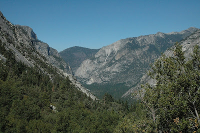
From 2011-07-26 Tyndall & Williamson


The first list I used to form some peak scrambling goals is the 14ers. In California, 12 mountains top 14,000 feet, and three other peaks get honorary membership in the club despite not meeting the requirements of being a real independent mountain. Before this summer I had already climbed 5 of those peaks (Langley, Whitney, Muir, Split and North Palisade). My first target peaks for adding check marks to my list were Williamson and Tyndall. These two peaks lie barely a mile apart on the Sierra Crest just west of Independence, CA.

Afterwards, as the weather started to get warmer, I realized that if I were to have a chance at good snow conditions in the Palisade region I needed to get up there as soon as possible. There are 5 14ers located around the Palisade Glacier in the mountains west of Big Pine, CA and my plan was climb to the 4 summits I had not been to before.

My next two posts will be detailed trip reports on my two solo trips to the Sierra to climb 7 of California's 14ers.

Thursday, June 16, 2011

A Renewed Period of Writing

Well, it has been nearly three years since last I posted on this blog and I am sure I will have to remind all my loyal followers (mom and dad) of the blog address. but I have been reminded by one of my dear friends that some people liked to read my writing and liked to be able to keep track of me. I have what some people might consider to be an interesting job. I get to travel and meet new people and try new foods. Plus I have new camera (Nikon D7000 - two more zeros than my last rig) so readers of this blog might get to see some pictures (and video) of my adventures as well.

From 2011-06-09 Yosemite060711


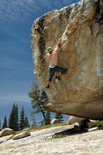
So far as I can remember, this has been the best June of my life. My birthday is June 7th and this year I spent that day in Yosemite Valley with some fantastic friends, looking at amazing scenery, climbing awesome rock, and marveling at my friends' ability to lead moderately hard trad on (sometimes soaking) wet rock.

From 2011-06-09 Yosemite060711


From 2011-06-09 Yosemite060711


I had 9 days off from work around my birthday and I managed to climb at least a little on the first six of those in a row. Two days at the top of the Palm Springs tramway, one day at the Bat Cave in LA and three days in Yosemite. There was boulders, sport climbing and trad climbing, and it was glorious. I had no great sends but tons and tons of fun.

After my climbing extravaganza, during which I turned 32 years old, I got to have one day to recover at home in LA before taking off again to traipse around in the backcountry of Sequoia National Park with a great friend who is just as excited about as I am about walking 13 miles in 6.5 hours.
From 2011-06-12 RMG Hike 061011


And on top of that, Olga is even more gung ho than I am about humping her way across a log over a raging early season creek. This adventure led to having wine and cheese next to the campfire under a giant sequoia, with bears for neighbors and it totally rocked.

From 2011-06-12 RMG Hike 061011


From 2011-06-12 RMG Hike 061011


Immediately after returning from this awesomeness I departed for another tour of duty on the Best Thing I Ever Ate. This time my trip was cut short as I was pulled back to LA after a mere three days. However during those three days I got to shoot and eat in Minneapolis, Madison and Chicago. I tried butterburgers, fried cheese curds and Filipino food for the first time and all were vastly superior to my expectations.

Hopefully I will keep posting here and the posts will get more exciting and possibly even better written.

Wednesday, October 15, 2008

The Big Loop: Day 23

DAY 23

From The Big Loop


Now it's just down. I climbed Avalanche Pass in the shadow of the Sphinx Crest and emerged into the sunlight atop my final pass of the trip. Well, actually about 150'below the top, but I think I have earned some poetic license in this case.

From The Big Loop


I slept pretty well and started hiking at 6, getting here at 8:40. I've just had a double breakfast to finish my granola, and now I am ready to go down to Road's end and see if my car is still there. I have 6-9 miles left, 2-4 hours depending on trail conditions...

From The Big Loop


Made It!!! It was 9 miles and not too bad. Got to Road's End just before 12:30 under 6 hours for the 15 miles from Roaring River to Road's End. Car's here and intact. Time for food and river washing, not in that order.

From The Big Loop


Final thoughts to come early next week. Probably...

Tuesday, October 14, 2008

The Big Loop: Day 22

DAY 22

I guess the wind chimed mules get the last laugh, as it is now 2:30am and they just went by my campsite. watering time maybe...


From The Big Loop


I couldn't sleep, again. But I was not uncomfortable this time. I read a bit, confident that I will finish hiking before I finish my book. But eventually I decided to get up and start walking. My route today takes me down to 8,000'. Which is where I am now at 7:45am. The sun has not yet risen high enough to reach the canyon floor and it is even a bit chilly here, now that I have stopped walking.

From The Big Loop


This spacious grove of immense pine trees at the trail junction probably bakes at noon. But for now it is cool and pleasant. By rough calculations based on my TOPO! mapping of the route, and park signs (neither of which is very reliable) I have 26 miles to go. 8.5 to Colby Pass, which is almost 4,000' of gain, followed by a drop of 4,500' to the Roaring River Ranger Station. Should be about 16 miles to there, and then only 10 over Avalanche Pass and down to Road's End. But 3,500' to Avalanche Pass followed by 5000' down to Road's End, my body won't thank me until I reach the car and stop for good.

From The Big Loop


Jeezum Crow!! What a pass! Colby is both one of the prettiest and one of the roughest Passes I have done. The trail was rubbish. Steep, loose and poorly maintained (editor's note: Turns out it is, in fact, not maintained at all.) at one point, I lost the trail and had an easier time going cross country. In fact many of my cross country passes were easier. But the up is done and soon I will start the descent.

From The Big Loop


From The Big Loop


In fact I finished the ascent a bit faster than I had guessed. Although I though I was being overly conservative at the time. Great views from up here.

From The Big Loop


However ants seem determined to crawl up my shorts, so I will stop writing and head down. One pass to go.

Songs in My Head: Harlem Globetrotters' Theme, and Rainy Day women came back as my trudging uphill song.

From The Big Loop


Guh. I walked too much today. Made it to Roaring River. 27.2 miles according to signage. I did enjoy the scenery greatly. Colby Pass was a fitting end to the trip, rough and though and beautiful. (Am I looking past Avalanche Pass? You bet I am. Did I learn my lesson on Colby? Nope!) I went over my 10 hour limit to get here, but I did not want tomorrow to be a full day. Probably stupid of me. I have enough food for three meals. 12-15 miles is the word of mouth estimate. Sign says 6.0 to the top of Avalanche Pass from here. 6 mile miles to go up 2600'. And then down 5000'.

It is warm here. And low: 7,400' maybe my lowest night of the trip. I hope ti stays warm. I'd like to get a full night's sleep, although when you go to bed @ 8:30 you don't have to sleep in to get a full night.

I had hummus and tuna burritos for dinner tonight, both brilliant and delicious. I have enough stuff to do it again too. But hopefully I'll be eating a burger or something instead.

Friday, October 10, 2008

The Big Loop: Day 21 & 22

DAY 21

From The Big Loop


Well, I can't sleep anymore. It's not that cold. I am not sure what the problem is, maybe I was spoiled by last night. It looks like 8:30pm-1:30am is all I am going to get. So, my Tyndall alpine start is turning into a Whitney alpine start. It is 2:15am now and I should hit the trail before 3am. The moon came up just a little while ago so I might not burn too much battery time. 13 or 14 miles to the summit, on top by 10?

From The Big Loop


From The Big Loop


From The Big Loop


From The Big Loop


4:00PM UPDATE: Did it. Both summits and food scrounging. I was on top by 8:40 and it seemed like I was first, but then I found 3 Italians in the shelter. I was the first to sign the register at least. I got up Muir Peak too. It was both fun and not too hard. Got some tuna and tortilla from some NJ hikers. Oh yeah, Slim Jims too! Those are gone now. I've had a swim, a nap and a binge since returning to Guitar Lake. I'm now going to eat some more and then trip down hill for a bit. Only 37 more miles to go.

Current Song: Lump - Presidents of the United States of America

I have been measuring my progress by maps, since I don't know any mileages. Making it to a new page is good progress and now there are only 7 left and one will be done before tomorrow. (I think.)

From The Big Loop


I have camped by a stream to the south of Big Sandy Meadow. Not a lot of walking from Guitar, but the Whitney map is done and there are only 6 more to go. Yesterday I felt beat up and hungry and my feet were done, at this time. Today I am still tired but my feet are okay, I am full and I have both a sense of accomplishment and the joyous feeling of heading for home with a sense of fulfillment. I have loved this trip. I has been one of the most amazing things I have ever done. But I am ready to BE done. I am not tired of what I am doing. But it is time to be doing something else nonetheless. I am not wishing for "civilized" things, although they will be nice. And I am not eating my hummus and tortillas thinking, "I am SO OVER this food." Overall, I think my body is ready to slow down a bit and mentally I am psyched to be finishing such a big adventure, safely and in high spirits, and with my love for the Sierra multiplied rather than beaten down. (Gee. Hope I am not jumping the gun here. But on the other hand, 33 miles or so seems pretty close these days) I suppose I could make it out tomorrow with a BIG long day,(editor's note: this turned out to be untrue, or at least it would have been a nearly 24 hour effort) but there is no need to rush. I will just continue to move at my regular, although admittedly fast, pace.

For my last thought of the day I would like to say how freaky it is to be walking through a wilderness area at 4 in the morning, miles from anything and to hear wind chimes... when there is no wind. As I approached the source of the wind chimes I noticed that someone had picketed their mules in a Meadow with some very musical bells on. I hope the ringing bells from me walking by woke them up cause it sure weirded me out for a second or three.

DAY 22

I guess the wind chimed mules get the last laugh, as it is now 2:30am and they just went by my campsite. watering time maybe...


(to be continued...)

Thursday, October 9, 2008

The Big Loop: Day 20

DAY 20

From The Big Loop


Feeling much better today. I hit the trail at 5:35am trying to get in some hiking under the stars, but I only got about a 1/4 mile down the trail before I could no longer make out Orion. My bivy cave was extremely comfortable, and I slept much better than the previous night. I topped out Glen pass around 6:50 or so. What a trail. Hard to believe there can even be a trail when you are on the final approach to the pass.

From The Big Loop


After a short break I hustled down from the pass only to run into a 45 minute conversation with a ranger from Joshua Tree NP, who was in the Sierra for the first time. I guess he has to be official so much of the time, it (editor's note: it refers to an extended rant on global warming and the state of our society) all came spilling out in this freer setting. (People get naked all the time in the mountains, no one seems to care) I didn't mind listening or discussing, but I did want to get a move on sooner than I did. He seems to be having a great time in the Sierra and I am happy for him. We did bond over the desire for biscuits and gravy. He'll be getting his a bit sooner than I will, since he'll be out tomorrow and I have 3.5 more days after today (probably). 7 miles to Forester, lunch on top?

From The Big Loop


I did indeed lunch on top of Forester just before 2. And now I am sitting beside Tyndall creek just 16.1 miles from Whitney. I decided to scratch the ascent of Tyndall. It pains me to do so, because it looked so awesome as I walked by. And I had planned on it for a while.

From The Big Loop


However, as I walked up Forester Pass I felt a light burning sensation in my right hip-flexor. At first I thought it was just skin irritation, but it got worse and it was obviously the hip-flexor tendon. So, since Tyndall is not going anywhere and I have 58 more miles back to the car, I decided it was wisest to skip this one goal. Especially considering how beat I was yesterday (the day after Split). Now I am going to go sedately down the trail towards Whitney for another hour or so and then tomorrow I will just head to Guitar Lake. I suppose if I get there super early I may have time and energy for heading up Whitney and Muir (weather permitting). But I am not counting on it. A nice easy day tomorrow will not go amiss. With some luck I can flesh out my food supply too.

From The Big Loop


I managed to get over Bighorn Plateau and catch my first glimpse of Whitney Russel and Muir. The view up on the Plateau is absolutely entrancing. Whitney, Russel and Muir, to the left and the whole "Mount Brewer Wall" , to steal Clarence King's description, to the right. Just amazing views in every direction. I rode out a short rain storm in the bivy sack just after I found a campsite on Wright Creek. I am going to sleep without the wet bivy sack, hopefully there'll be no rain or severe wind. I am pretty close to Whitney now, as in I should be able to get up to the summit tomorrow in good weather. I guess it depends on which mileages you can believe. If it is only 13 miles to the top from here and then 5 back to Guitar Lake then I will make it for sure. If it is 9 to Guitar Lake and then 10 more round trip to the top, it might be a closer thing. Although, that is only 1 mile different... I guess I'll just have to walk to Guitar Lake and see what the situation is.