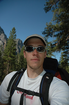
Thursday, September 25, 2008

The Big Loop: Day 15 & 16

Whoops. I guess I shouldn't go on anymore visits to the Bay Area if I want to finish this trip report. I am going to try to get out the 9 days without any more long gaps like this.

DAY 15

The feet are not doing well. I awoke cold and unable to get comfortable at about 4:15am and decided to get up and start walking as the best way to get warm. This was inspired both by Brandon and Clarence King who each made "alpine" starts sounds so nice. And it was very nice. However, first I had to deal with my feet. I fashioned a gauze and duct tape patch for my left foot. And it seemed to work as it is now lunch and my wound seems no worse, despite my walking on it for a good ways. However, the blood blister that I lanced on my 2nd toe on the left foot just moved operations slightly to the right. There is also a mirror blister on the same toe on my other foot. If things do not improve: 1) I will run out of duct tape, 2) I may not be able to finish. I know I can endure a lot, but I will have to ask "what is the point?" sometime. I am not proving anything to anyone at this time... but I want to finish. I am just not sure how much suffering it is worth to do so. I don't know if I can cut back my mileage enough for the left foot to heal and 9 more days is a long time for that to linger without real recuperation time. I think it needs multiple days, not just a night or a single rest day. I don't want to take any either. The rest of my body feels just fine, even vigorous.

On the other hand I did get a beer and a hot dog at the top of Silver Pass for Graham and crew. They awesome folks who pack in beer and hot dogs to give away to hikers. They do it for couple weeks every year for the last three years. Seems like an awesome bunch. And the PBR was not bad. Graham is an IPA fan and I would like to hook him up some time.

From The Big Loop


Well, I had a moment there where I wanted to give up. Feet were sucking, and one of my eyes was rejecting contacts. On top of this I was humping 10 days of food up 2000' of switchbacks through a dry pine forest with no view to speak of. Not my finest hour on the JMT. But, mere minutes later I said, "fuck it." All I need is some more duct tape and the feet will last to home. They won't be happy, and I may limp for a few days but they'll get the job done. Plus my eye will be fine (and it was, after an hour of no contact). So I kept moving along the most boring section of trail on the JMT. And now I am hitting the sack with a positive attitude. Just need to keep bumming duct tape from other hikers.

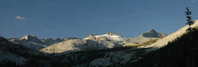
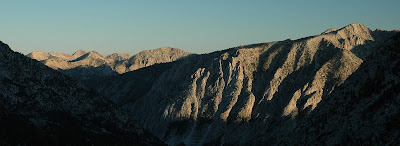
Doing the High Route first was a mistake... and yet not. it sure does make a lot of the JMT seem tedious. But, if I do have to bail out on part of the trip, I sure am glad it is the JMT and not the High Route. However, I would prefer to bail on the JMT section that I did over these last three days rather than the part in Sequoia and King's Canyon. I don't plan to ever walk these last sections again, not as part of the JMT anyway. I may go into the areas for fun, just not to hike through. Once you leave Donahue Pass the scenery gets pretty boring and far away. there are brief exceptions but they become fewer the farther south you get. However, I should be in SEKI tomorrow afternoon. And I will be very happy about that.

DAY 16

From The Big Loop


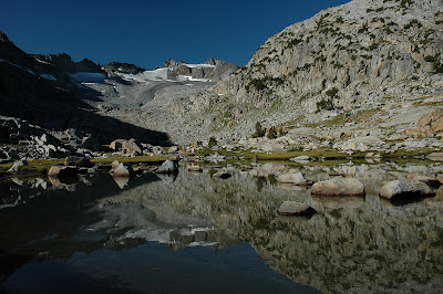
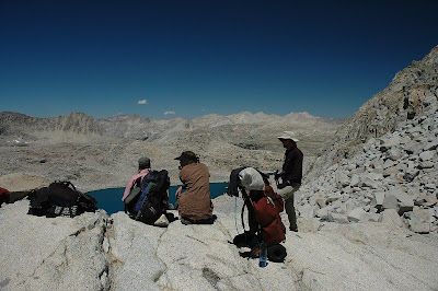
Wow, it was an interesting, people-filled day. I got up earlyish cause I wasn't sleeping any more, and managed to hit the trail by 5:45. I moved Selden Pass as the sun rose, reaching Marie Lakes right around 8 where I had a nice literary discussion with a girl whose name I can't remember (as always). I moved up to the pass for breakfast and was passed by a guy who turned out to be Alan from Texas.

From The Big Loop


I caught up with him just past Heart Lake (where I saw two chukars) and he and I booked it down to the Muir Trail Ranch together, reaching it just before noon. we proceeded to hang out and scrounge goodies from the hiker buckets. I stayed until 3:30 and met Mary and Michelle who were continuing north despite having no plans and no supplies (now they have plenty thanks to the hiker buckets). I then left to head into Kings Canyon (yeah!) and shortly met Paul. Paul is an experienced Sierra Hiker who I had a great time chatting with, and on top of that he ended up sharing his delicious hot dinner with me, mac and cheese with bacon bits. He also mentioned the High Sierra Hikers Guide from the 70's with maps containing off trail routes now lost to obscurity (sort of).

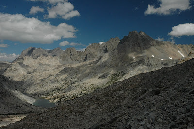
In the end I have moved from Bear Creek over Selden Pass to camp along the west bank of the South Fork of the San Joaquin River. Maybe 5 miles inside the Park. Tomorrow I should get over Muir Pass into LeConte Canyon. (As long as I can still walk on these feet).

Tuesday, September 16, 2008

The Big Loop: Day 13 & 14

DAY 13

From The Big Loop


Well, I cranked the hell out of my ankle, again. But I walked it off and it seems okay. I was just yards away from my lunch break when it happened. Stupid Minarets. Although I think it was more my fault for being too fatigued. I've stopped for lunch at 2:00pm just above (and past) Garnet Lake. It is certainly a long way towards Red's Meadow from Tuolumne, especially since I should still get in 2 or 3 more hours of trail time before camping. Some clouds appear to be moving in from the south. I am not sure what that means for my weather tonight. With any luck they'll stay east of me.

Ran into two repeat customers today. Trevor from the backpacker's campground in Tuolumne and blue hat guy that I met while heading north on the John Muir Trail past Palisade Lakes. I think we were both a little surprised to run into each other, and he failed to recognize me right away because of the increase in my facial hair. Donahue Pass was about as lovely as I remembered it, despite my much great wealth of comparison material as opposed to the last time I saw it.

From The Big Loop


Thousand Island Lake and the surrounding lakes are very cool, but the Ritter Range just doesn't feel the same as other parts of the Sierra. Fortunately, I shall be back in the good stuff very soon, especially at this pace.

So I think I accomplished my goal of finishing all the uphill portions of trail between me and Red's Meadow. In fact I should be there for breakfast tomorrow. And that will allow an early start on the post-Red's Meadow JMT. I think that today's pace was too high. I don't believe my feet can sustain it for the long haul. The ankle seems okay. not good, but good enough. I am excited to get the rest of my maps tomorrow so I can look over the rest of the route. I can't wait to get back to the Sequoia/Kings Canyon section of the trail. Minor foot pain is my only real problem. All my other systems appear to be running just fine.

Oh, the trail after lunch today was not too interesting until Rosalee Lake and Gladys Lake, both had cool cliffs at their edges and nice evening light. Their were huge crags near Shadow Lake, I wonder if people climb on them...


DAY 14

From The Big Loop


Got up early and a bit damp. Need to air out the sleeping bag and bivy sack wherever needed. Maybe I should use the walking drying technique. Well, I have come and gone from Red's Meadow. Hit the trail just before 6 and rolled down to Red's Meadow by 8:20.

From The Big Loop


I had a frustrating photo experience on the way. Great clouds and light an the Minarets were blocked by the the trees and when I ran down to a meadow for a clear view I was too low and closer hill blocked the shot.

From The Big Loop


I got my breakfast at the cafe and my resupply box from the store. I jammed as much food as I could into my pack. It will not all fit in the bear can, looks like some of it will be in my pillow. I met a jazz bass player named Brandon who hiked from Lodgepole to Red's Meadow in 7 days and now has to quit cause his feet are giving up.

I left at 11:45 and hiked a couple hours to just short of Deer Creek. I should be able to hike until 7 or so tonight so we'll see how far I get. I might be able to get past Tully Hole.

Nope. Close though. I have stopped at Lake Virginia, lake shaped somewhat like the state of Virginia. It was a cool day even lower down in elevation. I don't know why I was surprised by how cold it is here. I am all bundled up and ready for the evening. I have chose a campsite at the edge of a talus field by the lake. There are some columbine flowers blooming nearby and that made me very happy, but ti did not last. I am facing potential disaster on my left foot. I was of the opinion that I would just walk through whatever skin pain I felt, muscles and joints might be different, but skin is just skin. Unfortunately a blister formed deep under the skin on the ball of my foot behind my left middle toe. The fluid in the blister found an outlet in the weak skin between my toes (2nd + 3rd), basically none of the skin in that region will survive, meaning I have at least a 2 inch square patch of raw skin, some of which is very deep. I am not sure how I will be able to function with this condition tomorrow and the next ten days. I guess it's appearance in the morning will be very significant. Other than foot skin I feel great and I have no doubt I would nearly fly on the way to Whitney. I am not prepare to stop now. Grr.

Friday, September 12, 2008

The Big Loop: Day 11 & 12

Day 11

From The Big Loop


Not much to say about today. A long walk on a trail or three. But I got my cheeseburger and a beer and some ice cream. A whole pint of Ben and Jerry's Phish Food. Yosemite is beautiful and I loved seeing the familiar rock as I got closer to Tuolumne. Sam and incredible waterfall along the Isberg Pass trail between the Lyell fork of the Merced and Lewis Creek. Met some cool folks around the Meadow. Tomorrow I will try to get to the Valley and back for my rest day.

DAY 12

I decided not to go to the valley. When I thought about it I couldn't see the point of paying $15 to get down and back, arriving in Tuolumne at 6:50pm. That is a little late to get started. I want to head up the trail a bit tonight for free camping and getting out of range of the day hikers. So, I figured the only thing I really wanted was a good book. I am going to get the Norman Clyde book here in Tuolumne Meadows and call that good enough. I'll have a hamburger, a beer, maybe more ice cream, buy my batteries and hit the trail around 4pm. Crunches and push ups might be necessary too. I am expecting to do around 20 miles a day on the John Muir Trail along with climbing Split and Tyndall. A guide book in the store says it's 150 miles from Red's Meadow to Whitney and that sounds like 8 days to me. Based on food I have 12 days left. I may pick up more at the Muir Trail Ranch, but we shall see. Red's Meadow seems so close and to think I have only 10 more days after that... I suppose it is really dawning on me that I at at the true halfway point in time and challenge if not in distance.

From The Big Loop


Up til now I have been hauling ass on trails. I may need to take that down a peg or two. We'll see though. If there are only one or two passes a day the JMT could feel very different as compared to my expectations. Hmm, tomorrow night might be re-fried bean night again if I make it far enough to get my resupply the next day...

Well, trying a new beer is always interesting. This time especially so because in addition to tasting unlike any other beer I have had (other double IPA's, I mean) it also knocked me on my ass. It was an interesting state to start out the JMT in. I had gone over to the Visitor's Center as a last resort for a good book to read, and had success with "Mountaineering in the Sierra Nevada" by Clarence King, as in Mount Clarence King, as in pay attention they didn't name a mountain after me for nothing...

Upon my return I resolved to get a burger, some ice cream and a beer to go with my burger. I decided to try the 395 IPA from Mammoth Brewing Company, but it was in a bomber. No problem I've drank bombers before and been fine. But I don't want to start out the JMT with Double IPA in my mouth, I'll need another beer to wash it down... In comes the Sammy Smith Nut Brown Ale. Needless to say given my lack of calorie surplus recently, the effect of these beers was to render my departure on the JMT into a bit of a fog.

Nonetheless I made it far enough down the trail to camp legally. I am just past the Evelyn Lake Trail in the ever flat, very long Lyell Canyon. I lucked out despite my "fog", making good time under threateningly cloudy skies, and distant rumbles of thunder. But, it didn't rain (more than a few drops) and the clouds kept me cooler than I had any right to expect. Well, I am hitting the sack early tonight. Tomorrow is my first real day on the John Muir Trail, and it will be interesting to see how close I get to Red's Meadow.

Thursday, September 11, 2008

The Big Loop: Day 9 & 10

Warning: The notes from Day 9 may contain objectionable language. It was not a good day.

DAY 9

From The Big Loop


Fuck the Minarets. Get me away from this gawdawful pile of volcanic, metamorphic fucking choss. Today I met the first person on the trail that I wished I had not met. Old dude told me that the Minarets were the most beautiful part of the High Route. What a load of shit. Ugly brown volcanic rock, loose, sandy slopes. A few nice waterfalls, lot of route finding through brush and trees. I have fallen, on my ass, at least 6 or 7 times! Before lunch! I've almost injured myself badly enough to have to quit! Twice!

I suppose if you like big pointy bits of choss with trees in between, the Minarets are great. I am not a fan. Also, dude told me "no" when I said I was aiming for North Glacier Pass. "No."? Maybe, "That'll be tough." or "That's pretty far." But, "No."? I didn't say I was going to walk to Tahoe or even Tuolumne... Then he examined my map to tell me how to go. And he told me how to ascend a pass. Like I can't figure that out on my own. I've only climbed 2-5 alpine passes a day for the last 8 days. He may be right about my making it over the pass, which is fine because it was only a goal and it might be warmer on this side tonight anyway. We'll see how things go after lunch.

DAY 10

From The Big Loop


Well, I got sleepy and didn't write anything last night. Which is just as well as I was in a foul mood. It was certainly the worst day I have had mentally. Might have been the worst day of the High Route for scenery too, I don;t find the Minarets that attractive. Must be the climber in e noting the rock quality. I am not sure why it was: my resupplied suddenly heavy pack, post rest-day fatigue, shitty rock, bushwhacking, or what, but I was stumbling around like a newborn colt yesterday. It was weird too, because I had a half rest day, big meals, and I slept for like 10 hours. Somehow that did not equal good day the following morning. Last night, however, it was damp, I ate dried hummus, and got chilly several times during the night, but I feel great this morning. I feel more nimble on the talus and here I am at the top of North Glacier Pass at 9am.

From The Big Loop


After this break for granola, writing and a bit of bedding drying, I set out across Bench Canyon, my last cross country section of the High Route. It is a bit sad, but also exciting. I know my feet will be happy with the vast reduction in talus hopping that comes with trail walking. This morning has been beautiful, and there were like 40 marmots enjoying it in the lower section of the pass.

From The Big Loop


I have traversed to just below Blue Lake, arriving at 2:30 just in time to meet a group of Scouts doing the same route as me (editors note: only the same route through the Bench Canyon area). They were consulting the map to determine the best route to continue. I've been invited to camp w/ them at Blue Lake. I'm certainly thinking about it, but also about ice cream at the Tuolumne Meadows store. If I do the pass early tomorrow with the Scouts, I should still make it for ice cream, we'll have to see how I feel when I get up there.

The hike today has been going well. I have felt inspired by the scenery rather than repulsed. There is quite a waterfall down from Lake Catherine. There has been some crazy chossy rock and lots of slabs, none of it has felt slippery like yesterday. It is sort of dry in this section, but there are places where it is wet and blooming with flowers. Lots of the pink/purple not-paintbrush (editors note: later found out that this flower is paintbrush of some kind, just not indian paintbrush). The upper of the Twin Island Lakes was very neat and full of fish. I can't stress enough how much of a complete 180 today has been compared to yesterday.

Bob Dylan's Rainy Day Women - I don't know why but it has been persistent.


Made it. I stepped on to the trail at 7:00pm, it took a bit longer than I had expected after going over the pass near Foerester Peak. It was all easy walking though it was no problem, even when I thought I might have missed the trail. I hit the trail and immediately ran down some switchbacks that looked nasty on the map (and they were in reality too). I didn't want to leave them for tomorrow, and today nothing could trump my feeling of bliss from diving naked into the lake on the Yosemite side of my last cross country High Route pass.

From The Big Loop


It is amazing how quickly I can go from having such near misery on the trail yesterday to near transcendent bliss today. I think it may be that my natural state is bliss when I am out here and the bad day just made everything seem that much better today. It is going to take me a while to get to Toulumne Meadows tomorrow. I have to remember not to try to run there. I may even have to eat breakfast AND lunch before I get there. Relaxing is the name of the game. Every step gets me closer, and I will get there tomorrow. (Camped in the canyon of the Lyell Fork of the Merced River)
.

Tuesday, September 9, 2008

The Big Loop: Day 7 & 8

Day 7

From The Big Loop


Met Chris and Jannine from Tahoe at Laurel Lake. They seemed very cool, making up thier own High route for 7 days out of Pine Creek. The descent down Mills Creek and Second Recess was nice in the shade. A bit rough, but it is cross country. I did do a fair amount of bushwacking, but it can be avoided, I think. The trail up laurel creek was nasty, exposed, overgrown with manzanita, steep, rocky and dusty when it was not rocky. Laurel Creek Canyon and the Lake were quite nice, lots of cool boulders around the lake. Very clear day.

From The Big Loop


Ran out of water up Red Finch Pass and decided to stick it out until the other side of Silver Divide hoping the north facing bowl would still be melting off. This did pay off. Made it to Cotton Lake for lunch, lots of nice super-polished slabs around.

Songs in my head so far: Ballroom Blitz (could be the worst video I have ever seen, even making allowances for how long ago it was made), The Humans are Dead, Hot in Herre, Frere Jacques, and my cadence getting mixed up with Thumb War declarations.

From The Big Loop


On and off the John Muir Trail again. After lunch I wandered down to Lake Issac Walton, which was very nice, then I negotiated some slabs and gullies to reach the trail through "Horse Heaven." A short while late I hit "Tully Hole" and the JMT. I started walking on it at 5:30pm and got off right at 7:48pm. It was good time to walk that section of the trail because the temps were good and the setting sun was pretty. Red's Meadow tomorrow. (I am camped just off the trail before Duck Lake)

DAY 8

From The Big Loop


Well now, that was a section of the High Route I will never need to repeat. Mammoth Crest was nice, there were some cool views, and the Deer Lakes and Duck Lake are worth seeing. However, the crappy sandy walking, sun exposure and the long descent to Red's Meadow are not thing I'll remember as fondly as I will the rest of the High Route. I failed to make it to breakfast at Red's Meadow. I rolled in at about 11am. I did get a double cheeseburger and a salad. The burger was almost big enough to justify the price. There were menu items with country gravy, so I was not disappointed to miss breakfast by mere minutes. I ate, got my resupply (crap, the pack is heavy again), and mostly hung around shooting the shit with Jamie from NYC. Cool guy, a recent cancer survivor walking off his convalescence. I must be getting hairy in the face, no one thinks it is surprising that I am 29. red's was a zoo with high school and younger kids. But nonetheless, after making the requisite phone calls, I stayed until 5pm before marching down the trail in order tog et back off the JMT before camping. Mo way I would pay to camp down in that pit. I am camped at a pretty random spot tonight right around 9000' just after some switchbacks on the Beck Lakes Trail. Hopefully, this will be warmer than the other night recently.

Age of Aquarius - who knows why?

looks like 2-3 days to Tuolumne and ice cream!

Monday, September 8, 2008

The Big Loop: Day 5 & 6

Well I fell behind (as I suspected I would), so now I have to play catch up. Well here it goes.

DAY 5

From The Big Loop


I was a lazy ass this morning. Got up slow, but found the two girls on the High Route. Turns out they are from Santa Cruz. They were psyched to have someone to tag along with for the trip over Alpine Col (this looked easier than The Keyhole). Shortly after I met them, Danieal, the guy I met at Evolution Lake yesterday came up. Turns out these were the girls he was looking for. Seems a bit crazy, but brought some great food that he is sharing readily. Gave me a hard boiled egg with breakfast.

From The Big Loop


The talus is super rough on the north side of Alpine Col. But the view is beautiful on both sides, and I managed to take a few photos. The talus gnats were awful on the south side lake shore and about as bad on the north. They swarm whe the wind dies down. Weird noise they make all together.

From The Big Loop


Well, Tori, Lacey and Daniel finally made it down to whre I was waiting round 3:30. I hung out for a little while longer before making my goodbyes. I had plans to over Puppet Pass before dark. I crossed Humphreys Basin pretty quickly even though it didn't seem that way. It was very different from the last time I was here with Amanda, no snow, very dry and lupine blooming.

From The Big Loop


Mesa Lake was amazing. Green grass lawn, white boulders and an amazing view of the Glacier Divide.

From The Big Loop


The up and over of Puppet Pass wasn't too bad and I managed to be on my way down to Lake Elba by 7. I found a bivy spot just south west of Lake Elba. I managed to botch re-fried bean night by adding too much water, but thanks to Daniel it was already a "2 hard boiled eggs and a chocolate chip cookie" day. Third hand word is that White Bear Pass is scary. I might find out first hand tomorrow.

From The Big Loop


DAY 6

From The Big Loop


Damn, what a cold night. Below 30 at one point, I was wearing all my clothes. Well, it led to an early start where I was passed for the first time (sort of). I ran into the Sierra Challenge crew by Merriam Lake.

From The Big Loop


They were headed for Gemini out of the Pine Creek trail head. After that I came across several more groups, including a friend of Roper's and his granddaughter, and two guys from Alabama and Mississippi. I guess a weekend'll do that. Apparently today is Sunday. Despite stops to chat, I made it to White Bear Lake around 1:30 and took a swim, in addition to my usual lunch time activities.

From The Big Loop


I am going to head to Jumble Lake instead of dropping to Brown Bear Lake. I think it will save time and be a bit more pleasant. I am a bit tired of long stretches of talus.

Well, it was much easier, but it left me with a nasty stretch of talus along Lake Italy that would have be avoided on the other side of the lake. Ah well, I think it was still faster. Certainly not scary this way. Gabbot was easy, just long... And the Mills Creek drainage has been okay. More talus than my body wanted, but nice breaks from it and not too steep in any section. I was beat though, and my right ankle and knee tendon were complaining until I stopped, here at Lower Mills Creek Lake. The Lake is outstandingly beautiful and there were tons of fish jumping at sunset.

From The Big Loop


Would love to take Josh here for some fishing/backpacking. I have begun calling cadence to myself, in order to stay in motion going up hill. I am not sure if this is weird or sensible or maybe both. Also I have increased my pace of eating since I should reach red's Meadow in two days now, and because I don't think I am getting enough calories for the pace I am setting. It looks like I might finish the High route from Kings Canyon to Tuolumne in 9 or 10 days. That's pretty fast for so much cross country travel. Needless to say, I am almost certainly burning more than the 3000 calories per day I had planned on. 6 days is already my longest backpacking trip ever and I have maybe 20 more days left? Wow.

Thursday, September 4, 2008

The Big Loop: Day 3 & 4

DAY 3

From The Big Loop


Frozen Lake Pass first thing. Started about 6am, 1/2 hour to the top, and 30min down to the "Frozen" Lake. I had a pretty easy time in both directions, even got to glissade for a short stretch. Met the Aussies, Marion and Lou, at the junction with the JMT. They appear to be royal old school bad asses, doing the High Route at 65 and 67. After chatting with them I humped up and over Mather Pass and covered this portion of the JMT that coincides with the HR in about 2:18. Very, very nice scenery here.
From The Big Loop


Cirque Pass looks like a long slog, hopefully mostly on slabs.

Not slabs. Well some, but mostly talus traversing. I ended up high and left when I finally saw the actual pass so I just kept moving horizontallyuntil I hit the final part of the pass. I was hit by a few raindrops but it never started raining seriously despite some nasty looking clouds. I waited under a boulder to see if it would blow over, but when nothing happened (storm-wise) I just decided to get going. Potluck Pass was hard to figure out by looking at it, but it turned out to be really easy, with a nice use trail almost all the way up. Palisade Basin was beautiful and I made it almost all the way to Knapsack Pass before deciding to camp below the pass.

From The Big Loop


I met two ladies doing frog survey work just at that time. They invited me to hangout in the evening and even directed me to an awesome bivy cave. So awesome it is too bad it is not going to rain tonight.

DAY 4

From The Big Loop


Nice night in the cave. Got going by 6:45. Knapsack Pass was note a joke, but fairly easy anyways. Dusy was pretty in the morning. I've felt low on energy today, might have to do with the rolled ankle from yesterday. Or it might be the long sections of dusty trails. Or it could just be one of these things that happens on Day 4 of a long distance hike. Good thing I move pretty fast on the trails cause the JMT would be unattractive otherwise. Many Many people and lots of sand.

From The Big Loop


Guh. Over Muir Pass. Felt long but it was only about 1:45 from lunch. Got ahead of myself again in map reading. Mostly wishful thinking I guess. At least the actual Lake Helen was much more impressive than the lake I mistook for it. After Muir Pass it was a long descent through Evolution Basin. Lots of BIG Lakes, each with its own character. Evolution Lake was the best, maybe the coolest alpine lake I have seen.

From The Big Loop


Met several cool folks today and caught wind of a group of three ahead of me on the High Route. I am camped in Darwin Bench, to which I stumbled at about 7:10pm. The ankle feels better, as does my right knee tendon (the stepping one), but my feet were unhappy. Tomorrow may be a late start. I learned that I need to switch the side my camera sits on, because it unbalances my pack enough to make one shoulder work more than the other. Timor and Doung (a geochem professor at USC) are camped nearby and they gave me a cup of tea!

Wednesday, September 3, 2008

The Big Loop: Day 1 & 2

Well, my notes from day one are a bit on the light side so I thought I would throw in a few notes about the trip as a whole too. More like statistics I guess. I am a scientist so what can you expect.

My Big Loop was about 410 miles long and went over 36 mountain passes with 19 of those being cross country. According to my mapping software the total elevation gain was somewhere close to 94416', but the software is not that accurate. And it does not include the side trip I made to climb Split Mountain, one of the 3 14er's I climbed along the way. I would guess that in actuality the total was 5-10% higher than that. My high point was Mount Whitney at 14,497'. My low point was the start and finish at Road's End in King's Canyon at 5075'. My first 6 nights were all spent at above 10,000'. My lowest camping spot was at Roaring River 7,414' on the last night of my trip. My highest camp was at 11,745' just below Frozen Lake Pass on my second night. It seems like I may have gotten less and less able to stand cold nights.

The High Route starts out with the Copper Creek Trail that climbs over 5,000' in just 6.5 miles. Kind of a butt kicker to start out with, but as proves to be the case any time there is no way to avoid heading down below the tree line, Roper tries his best to get you back into the sub-alpine zone as fast as possible. In all the HR blasts from the floor of King's Canyon at 5075' up to Grouse Lake Pass at 11110' in a mere 8.2 miles. Guh. On day one I covered about 13.75 miles and went over two (easy) cross country passes.


DAY 1
(Notes presented without editing for content)

From The Big Loop


Damn hot and dusty up Copper Creek (steep!) kicked my ass (Passed a pack train!) Started at 8:40am. Got to Grouse Lake in about 4:20 (1:00pm). Storm moved in while resting and eating at Grouse, decided to get over 1st pass while lightning was still far away. Waited for storm to clear under boulder in 2nd cirque.

From The Big Loop


The storm cleared away to the NE, leaving me to cross Goat Crest and descend past 2 Glacier Lakes and through Glacier Valley. All super beautiful.

From The Big Loop


Totally made up for the 6000' hump from the trail head to "Grouse Lake" Pass. I am camping tonight at the upper of the State Lakes. Got here just before 8. ~3hrs from my storm boulder. I am one day in and this already feels like the best thing I have ever done.


DAY 2

From The Big Loop


I need to eat when I am hungry rather that waiting to reach certain landmarks. I have reached Marion Lake. I should have eaten lunch an hour ago, maybe 2. But I wanted to eat here, and so I have. I have hiked for 6 hours so far today (2pm). I have covered some good ground but I worked myself a bit too hard between meals and I ran out of juice coming down to this lake. The lake is possibly the 2nd most amazingly deep blue lake I have ever seen. Certainly not the aquamarine usually seen in the Sierra. Looks stormy again, but no rain yet. Very pretty again
today with more expansive views.

From The Big Loop


More talus though, I managed to take a few wrong turns, not that it was a real problem. Just not the best route.

From The Big Loop


Lake Basin was nice but chock full of mosquitoes. I wanted to rest more often but I was spurred on by the whine of little insects. There was a very steep section on the way to Frozen Lake Pass that I was not expecting, but it was still only class 1. So far the passes have been easy. But I guess if you have recently traversed Rosy Finch Peak, a lot of things will seem like a piece of cake. Surprisingly warm below FLP at 11,700'. Hope it stays this way.

From The Big Loop

Tuesday, September 2, 2008

A Short Update on a Long Walk

Well, it's been a long time. And I screwed up before I left. I meant to post about my drive back to LA and my stops at Badlands (cool but the camera batteries were drained), Mount Rushmore (disappointingly small and had pay parking that my park pass had no effect on), Yellowstone (as cool as ever) and Grand Teton (just a drive by). But I ran out of time in the rush to prepare for my trip to the mountains. So I am going to make it up to my loyal readers (Hi, Mom and Dad!) and post up a nice blow by blow account of my big hike in the Sierra.

The plan for this came about due to my continued drooling over the Sierra High Route which is a nebulous route put together by Steve Roper that travels roughly northward along the spine of the Sierra trying to stay in the magical zone above the treeline. The SHR incorporates a fair amount of cross country travel through areas that I had never even heard of before looking into the route. However, the route is not a loop there is a beginning and an end which is hundreds of miles away. So you can drive to one end, but then you need to figure out how to get back to your car at the start. If you have a partner or two you can take another car and leave it at the end, so that when you finish you just hop in and drive back to the start to pick up the other car.

Well I didn't have anybody to hike with me and I had lots of time so I decided to just walk back to my car, and since I would take the John Muir Trail most of the way back I figured I might as well complete the JMT and climb Mount Whitney. And from there it is just a few days back across the mountains and north to my car. I made my link from the SHR to the JMT at Tuolumne in Yosemite National Park. So in fact I cut both routes a bit shorter than the full length, but to try to link the two ends would have been very hard and might have required a car ride of some sort to make it not ridiculous. So I snipped of those end to tie it all together neatly. The whole loop comes out to something like 410 miles.


The red line is the High Route going North from Road's End in King's Canyon NP to Tuolumne in Yosemite NP. The blue line is the John Muir Trail heading South from Tuolumne to Mount Whitney. And the Yellow line is the route back to Road's end from Whitney over Colby Pass and Avalanche Pass.


On the hike I took a Thermarest Z-Lite sleeping pad, a Marmot Pounder 40 degree sleeping bag, an OR Aurora Bivy Sack, a Bearvault Bear Cannister, a headlamp, an Oricasa folding plastic bowl, a titanium folding spork, a 2L MSR Dromedary hydration pack, and a 1L Nalgene bottle. I had a few other odds and ends but that was the main gear list. And it all went in to a Lowe Alpine Cholaste 35L pack.

My food supply was fairly simple: Powdered milk and granola for breakfast, Nutella and tortillas for lunch and dried hummus and tortillas for dinner and cliff bars (Cool Mint Chocolate) to fill in between meals. I had a small supply of instant re-fried beans that substituted for the hummus on special occasions. On top of this, I had a little trail mix. But that is what I ate for 23 days or so. I started out with 10 days of food in my pack. I dropped off two resupply boxes at Red's Meadow near Mammoth. Red's Meadow is on the trail so I was able to resupply without heading in to town. I had one box with 6 days of food to last me up to Tuolumne and back to RM. And the other box had 10 days to get down to Whitney and then back to my car. (This is over 200 miles on 10 days of food, probably not good planning on my part, but it turned out not to be a problem due to several reasons that I will address as they come up.) Each box had an extra treat in it consisting of an 8oz Italian dry salami and an 8oz smoked cheese.

Before I left on the trip I went to do some alpine climbing with Dan Arnold. Basically this served to get me well acclimatized and ready for my hike. We also had a ton of fun traversing Rosy Finch Peak and climbing the North Arete of Bear Creek Spire and the North Buttress of Mount Goode.

From The Big Loop

Mount Goode

On all of our climbs we encountered Sky Pilot a type of Polemonium that only grows above 12,000'

From The Big Loop

Sky Pilot

We had a great time climbing, and along the way I dropped off my food boxes in Mammoth. On August 4th, I dropped off Dan in Fresno and drove in to King's Canyon to pick up a wilderness permit for the hike. Due to a weird set of independently administered rules permits for trips beginning on the next day are available only after 1pm, but the permit office closes at 2:30. Strange, but I think I understand why that odd state of affairs exists. Eventually I obtained my permit and drove back to Fresno to complete my necessary purchases (batteries for my camera) and to eat my last meal before heading into the woods. After accomplishing that I drove part way back to the park and camped somewhere off the road.

On August 5th, I got up and drove into the park where I went to the Cedar Grove Restaurant and got a double order of biscuits and gravy for breakfast. From there I drove to the Copper Creek Trailhead at Road's End and packed up my gear. I put all the smelly stuff from my car into a bear box with a distant expected return date, and set out on the trail at 8:40am.

From The Big Loop


To tell the rest of the story of my hike I will post in this space the exact notes I took from day to day along the trail. I scribbled them on the back of the maps I had printed out for the trip. These notes are by no means a comprehensive representation of my thoughts along the trail. I spent a lot of time on the trail by myself and there is no way I could capture all of my experiences in that respect. And on top of that most of them were written by a very tired guy just before he went to sleep and are a bit loopy and/or spotty in some cases. I will try to sprinkle in the appropriate photos in relevant places. (and as always, if you would like to see all of the photos I took you can click on any one of them and it will take you to the correct folder on my photo website.)

I will try to post a couple days of notes each day, starting tomorrow and continuing until I reach day 23. At which point I'll try to post something more to wrap up the trip my feeling from the trip and I guess that will be from about 3 weeks post trip and I might have some better perspective by then.